Hiking · Drakensberg, South Africa · recorded with NomadTracks
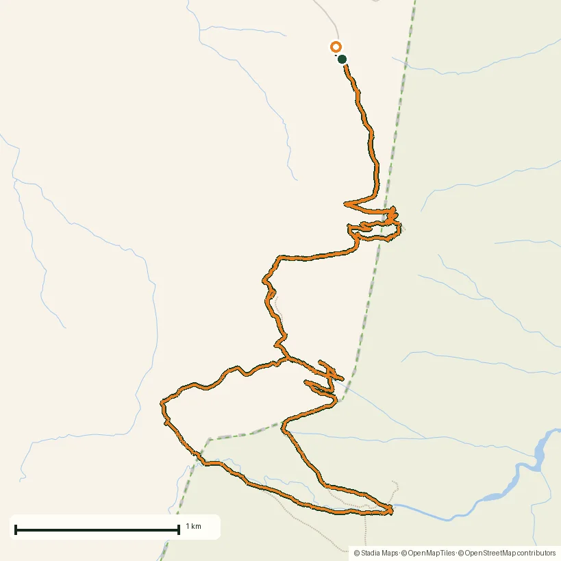
Drakensberg amphitheatre: 13 km to the top of Tugela Falls
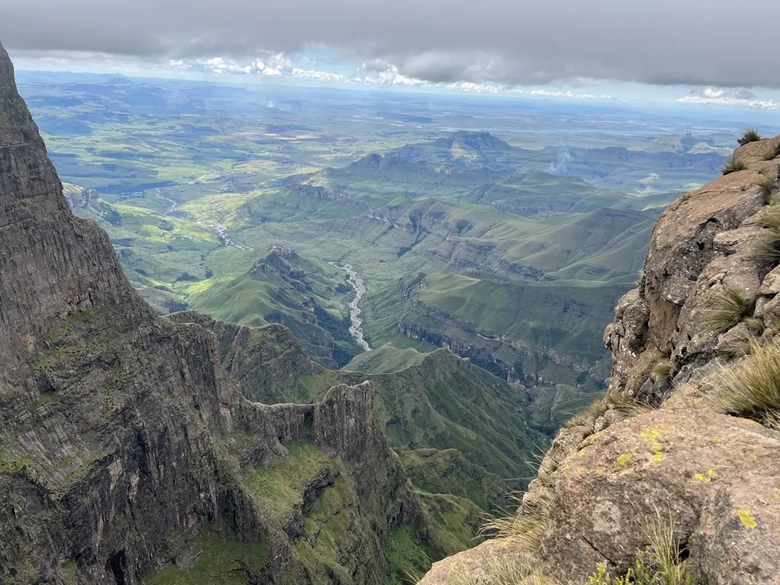
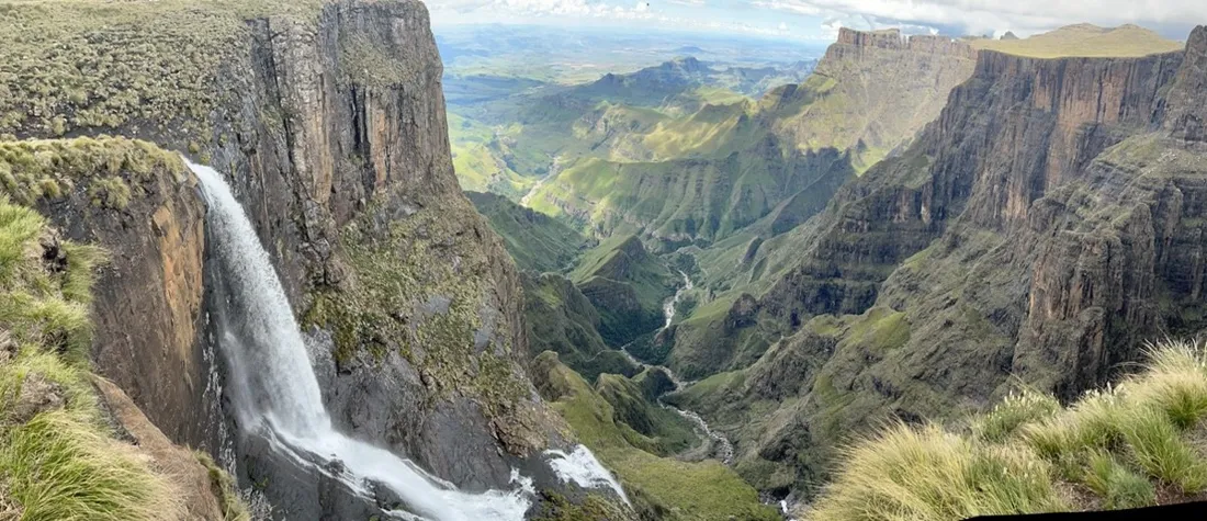
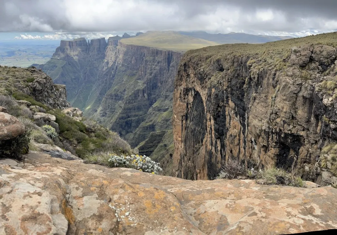
The Drakensberg amphitheatre is a five-kilometer wall of basalt, and this 13.1 km route climbs to its rim — where the Tugela river simply steps off the edge and falls the better part of a kilometer. About 830 m of gain, big exposure, bigger views.
About this data: this track and its photos were personally shared with us as samples by a NomadTracks user. NomadTracks never uploads, collects or shares your tracks or photos — your recordings stay on your devices and in your own cloud.
Download GPX Coordinates, elevation and relative times — recording dates are normalized out, photos not included.

Up the escarpment
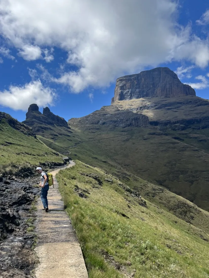
From the Sentinel side the route works up ramps and gullies to the plateau — the famous chain ladders are the crux, short but airy. On top, the world flattens absurdly: a grassy roof at 3,000 m with the falls' lip a casual stroll away.
Weather windows, recorded
Berg weather builds fast after noon. The recorded timeline is the honest debrief: how long the ascent really took and how much margin was left when the first clouds boiled up the wall — exactly the data that plans the next attempt better.
About the place: Drakensberg, South Africa
The Drakensberg amphitheatre in Royal Natal National Park, South Africa, is a five-kilometer basalt wall on the Lesotho border, and Tugela Falls — among the tallest waterfalls on earth at 948 m — pours straight off its rim. The hike starts at the Sentinel car park above Phuthaditjhaba; the chain-ladder section is short but airy, and mountain weather builds fast after midday year-round.
More track stories
- Overlanding Namibia: 4,250 km from the Kalahari to the Kunene
- Mount Whitney in two days: 24 km to the roof of the Lower 48
- Camps Bay to Table Mountain: the steep way up Cape Town's icon
- Dürrensee to the Drei Zinnen: a Dolomites classic
- Sailing the Šibenik archipelago: 69 nautical-style kilometers under sail
- Canoeing Caddo Lake: 9 km through a flooded cypress forest
- Mount Shasta mountain-bike loop: 28.6 km of volcano singletrack
- Lofoten lake hike: 9.6 km through Norway's green wilderness
- Cinder Cone, Lassen Volcanic NP: a 6 km climb up a perfect volcano
- The Olive Trail, Namib-Naukluft: 10.9 km through a desert canyon
- Mount St. Helens: 16 km through the blast zone to the viewpoints
- Double O Arch via Devils Garden: 12 km through Arches' fin country
- The everyday loop: 12 km of redwoods and fog above Redwood City
- Lake Tahoe rim ride: 28 km of singletrack above the blue
- Dewey Point in winter: 12 km on snowshoes to Yosemite's quiet rim
- Pinnacles High Peaks loop: 12 km among the condor spires
- Golden Canyon to Zabriskie badlands: 6 km below sea level
- Hoh Rain Forest: a 4 km walk through the moss cathedral
- Oahu waterfall trail: 5 km of mud, roots and jungle
- Riding to Lake Helen: 17 km up a closed park road through the snow
- Phillips Cave: a 6.5 km walk to Namibia's White Elephant rock art
- Koiimasis: 9 km through the granite of the Tiras Mountains
- Cathedral Gorge: a short ride through Nevada's clay cathedral
- Riding Black Rock City: the GPS trace of a city that doesn't exist
- Peekaboo Loop, Bryce Canyon: 15 km among the hoodoos