Mountain biking · Lake Tahoe, California/Nevada, USA · recorded with NomadTracks
Lake Tahoe rim ride: 28 km of singletrack above the blue
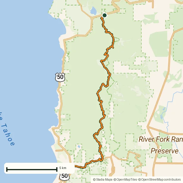
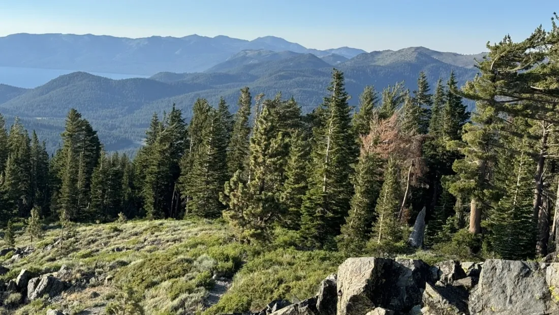
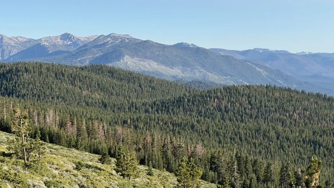
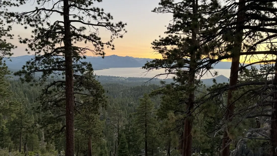
The trails on the rim above Lake Tahoe are the postcard ride of the Sierra: 28.1 km of sandy singletrack and granite slabs, about 700 m of climbing, and that absurd blue flashing between the pines on every second switchback.
About this data: this track and its photos were personally shared with us as samples by a NomadTracks user. NomadTracks never uploads, collects or shares your tracks or photos — your recordings stay on your devices and in your own cloud.
Download GPX Coordinates, elevation and relative times — recording dates are normalized out, photos not included.

Flow with a view problem
The hardest part of riding here is keeping your eyes on the trail. The recorded track quietly logs what memory can't — which overlook that was, how long the granite section actually lasted, and where the light got golden on the last descent.
Reading the ride afterwards
The speed chart separates the grinding fire-road start from the singletrack payoff, and the elevation profile shows the rim's gentle saw-tooth character. Export the GPX below and ride the same loop yourself.
About the place: Lake Tahoe, California/Nevada, USA
Lake Tahoe sits at 1,897 m in the Sierra Nevada on the California–Nevada line, and the trail system on its rim mixes legendary singletrack with granite slab riding. July through September is prime season — earlier the high sections hold snow, later the afternoon storms arrive. Altitude is real here: climbs that look modest on paper breathe like much bigger days.
More track stories
- Overlanding Namibia: 4,250 km from the Kalahari to the Kunene
- Mount Whitney in two days: 24 km to the roof of the Lower 48
- Camps Bay to Table Mountain: the steep way up Cape Town's icon
- Dürrensee to the Drei Zinnen: a Dolomites classic
- Sailing the Šibenik archipelago: 69 nautical-style kilometers under sail
- Canoeing Caddo Lake: 9 km through a flooded cypress forest
- Mount Shasta mountain-bike loop: 28.6 km of volcano singletrack
- Lofoten lake hike: 9.6 km through Norway's green wilderness
- Cinder Cone, Lassen Volcanic NP: a 6 km climb up a perfect volcano
- Drakensberg amphitheatre: 13 km to the top of Tugela Falls
- The Olive Trail, Namib-Naukluft: 10.9 km through a desert canyon
- Mount St. Helens: 16 km through the blast zone to the viewpoints
- Double O Arch via Devils Garden: 12 km through Arches' fin country
- The everyday loop: 12 km of redwoods and fog above Redwood City
- Dewey Point in winter: 12 km on snowshoes to Yosemite's quiet rim
- Pinnacles High Peaks loop: 12 km among the condor spires
- Golden Canyon to Zabriskie badlands: 6 km below sea level
- Hoh Rain Forest: a 4 km walk through the moss cathedral
- Oahu waterfall trail: 5 km of mud, roots and jungle
- Riding to Lake Helen: 17 km up a closed park road through the snow
- Phillips Cave: a 6.5 km walk to Namibia's White Elephant rock art
- Koiimasis: 9 km through the granite of the Tiras Mountains
- Cathedral Gorge: a short ride through Nevada's clay cathedral
- Riding Black Rock City: the GPS trace of a city that doesn't exist
- Peekaboo Loop, Bryce Canyon: 15 km among the hoodoos