Mountain biking · Mount Shasta, California, USA · recorded with NomadTracks
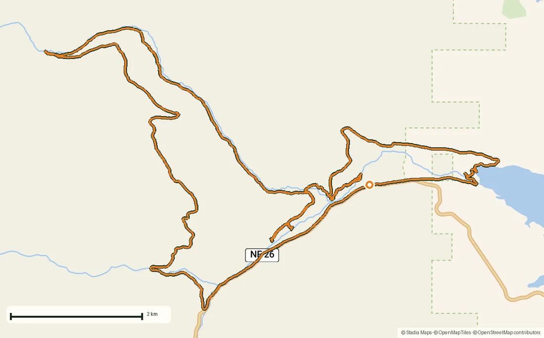
Mount Shasta mountain-bike loop: 28.6 km of volcano singletrack
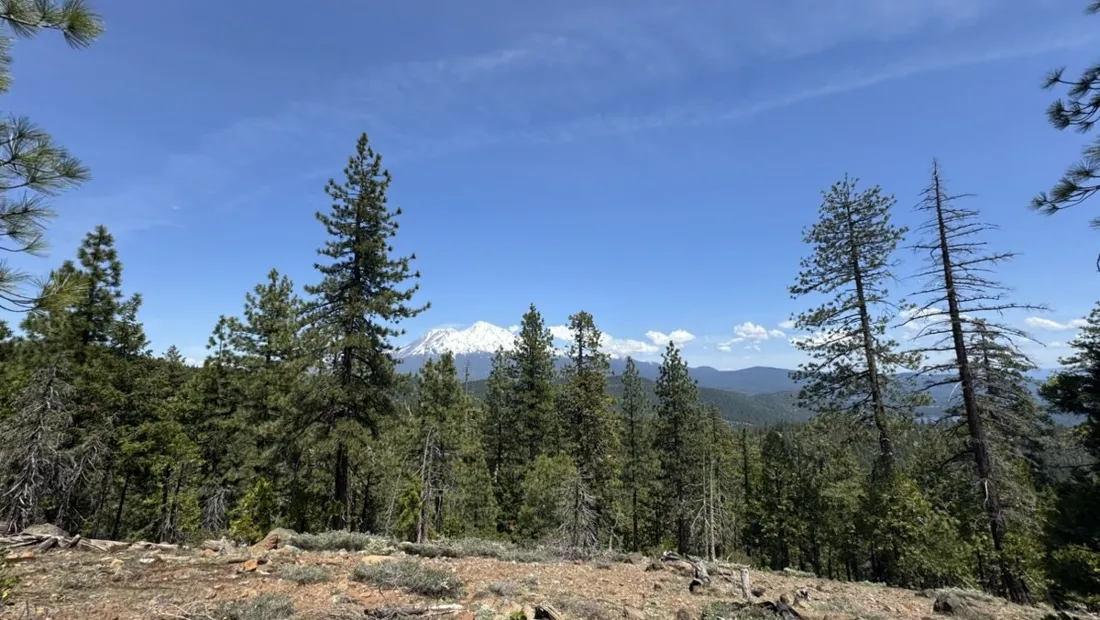
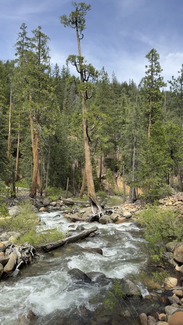
A 28.6 km loop on the flanks of a 4,300 m volcano: fast pumice singletrack, creek crossings, and Shasta's white cone appearing between the pines every time the trail swings north. Recorded gain: about 750 m, spread over climbs that are honest but never brutal.
About this data: this track and its photos were personally shared with us as samples by a NomadTracks user. NomadTracks never uploads, collects or shares your tracks or photos — your recordings stay on your devices and in your own cloud.
Download GPX Coordinates, elevation and relative times — recording dates are normalized out, photos not included.

Reading the loop afterwards
The speed chart is the fun part on a bike: you can replay every section — the grinding fire-road climb, then the long supple descent where the average jumps. Trimming the parking-lot meters off both ends with the crop tool takes seconds and keeps the stats honest.
Planning the next lap
The loop was pieced together the evening before with route planning on OpenStreetMap basemaps, which know the singletrack that generic maps miss — then saved as a track and simply followed. Plan vs. ride comparison afterwards: nearly congruent, 100 m of bonus climbing.
About the place: Mount Shasta, California, USA
Mount Shasta (4,322 m) dominates far-northern California, and the volcanic soils around the towns of Mount Shasta and McCloud drain into fast, smooth singletrack. The Gateway trail network and surrounding forest roads ride best from June to October once the snow line retreats; pumice surfaces stay grippy even in midsummer dust.
More track stories
- Overlanding Namibia: 4,250 km from the Kalahari to the Kunene
- Mount Whitney in two days: 24 km to the roof of the Lower 48
- Camps Bay to Table Mountain: the steep way up Cape Town's icon
- Dürrensee to the Drei Zinnen: a Dolomites classic
- Sailing the Šibenik archipelago: 69 nautical-style kilometers under sail
- Canoeing Caddo Lake: 9 km through a flooded cypress forest
- Lofoten lake hike: 9.6 km through Norway's green wilderness
- Cinder Cone, Lassen Volcanic NP: a 6 km climb up a perfect volcano
- Drakensberg amphitheatre: 13 km to the top of Tugela Falls
- The Olive Trail, Namib-Naukluft: 10.9 km through a desert canyon
- Mount St. Helens: 16 km through the blast zone to the viewpoints
- Double O Arch via Devils Garden: 12 km through Arches' fin country
- The everyday loop: 12 km of redwoods and fog above Redwood City
- Lake Tahoe rim ride: 28 km of singletrack above the blue
- Dewey Point in winter: 12 km on snowshoes to Yosemite's quiet rim
- Pinnacles High Peaks loop: 12 km among the condor spires
- Golden Canyon to Zabriskie badlands: 6 km below sea level
- Hoh Rain Forest: a 4 km walk through the moss cathedral
- Oahu waterfall trail: 5 km of mud, roots and jungle
- Riding to Lake Helen: 17 km up a closed park road through the snow
- Phillips Cave: a 6.5 km walk to Namibia's White Elephant rock art
- Koiimasis: 9 km through the granite of the Tiras Mountains
- Cathedral Gorge: a short ride through Nevada's clay cathedral
- Riding Black Rock City: the GPS trace of a city that doesn't exist
- Peekaboo Loop, Bryce Canyon: 15 km among the hoodoos