Hiking · Mount St. Helens, Washington, USA · recorded with NomadTracks
Mount St. Helens: 16 km through the blast zone to the viewpoints
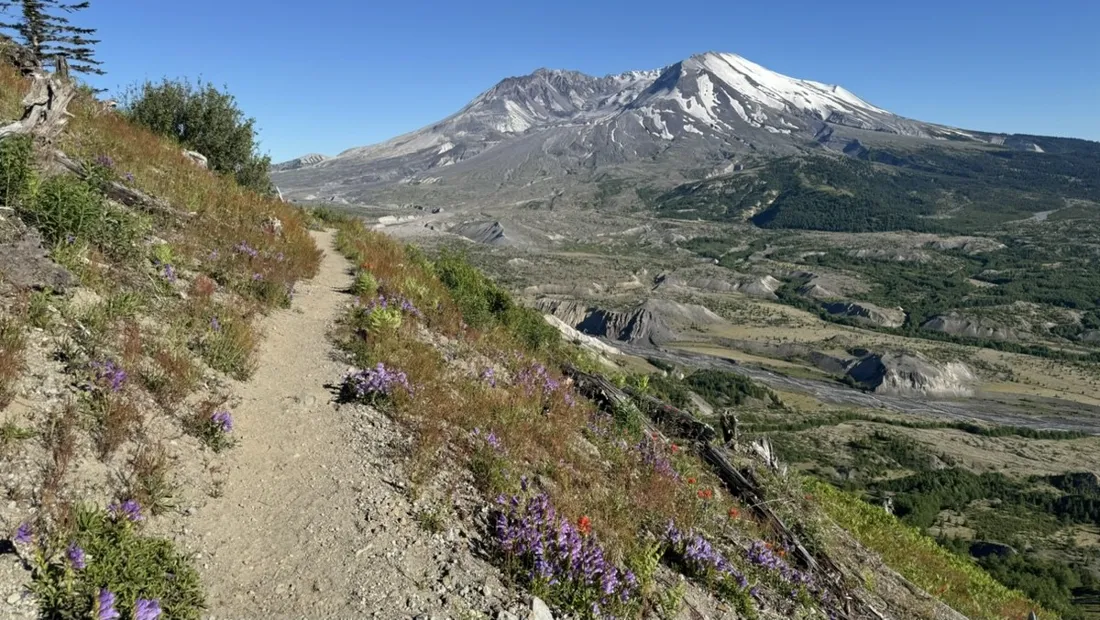
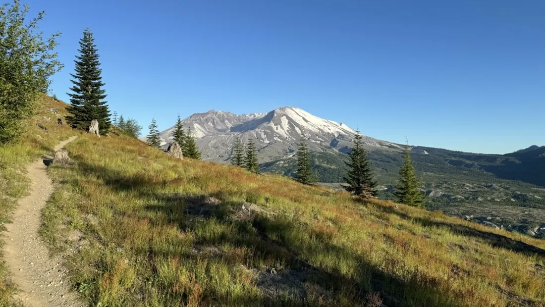
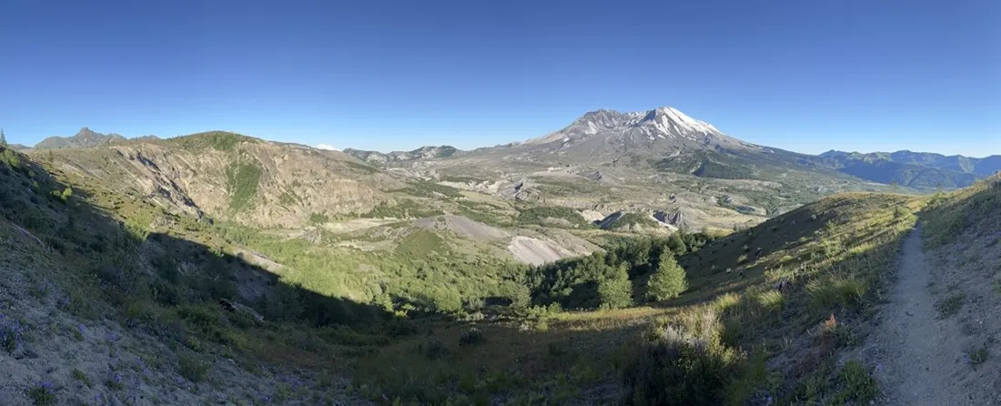
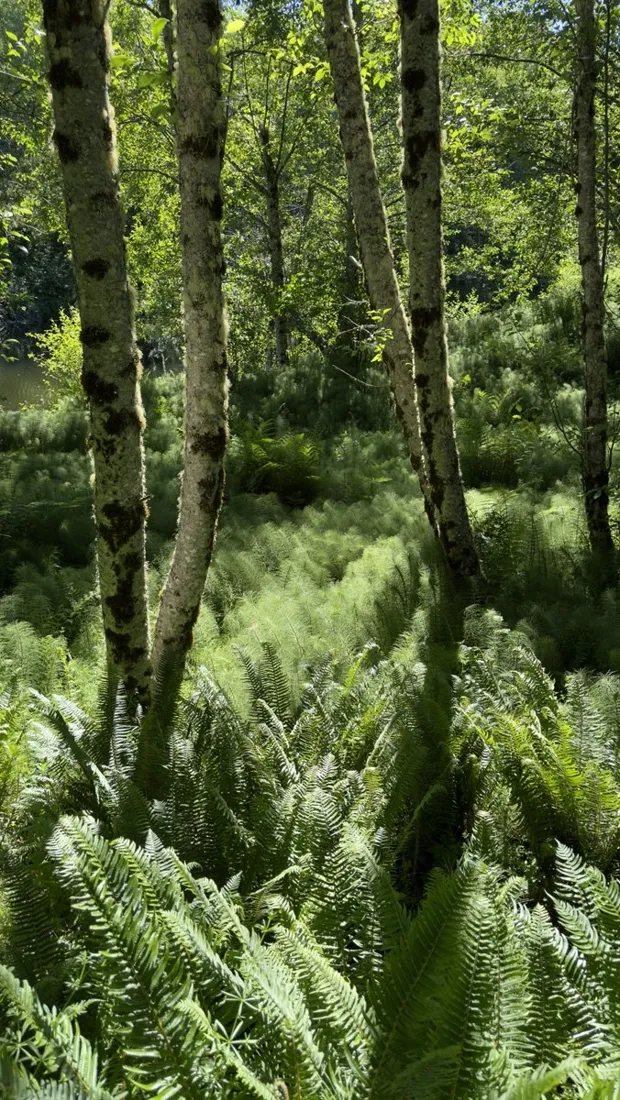
Few trails walk you through a geology lesson like this one: 16.2 km across the hummocks — house-sized chunks of the mountain that slid here in 1980 — with the open crater staring down the whole time. About 600 m of rolling gain, and lupines everywhere the eruption once sterilized.
About this data: this track and its photos were personally shared with us as samples by a NomadTracks user. NomadTracks never uploads, collects or shares your tracks or photos — your recordings stay on your devices and in your own cloud.
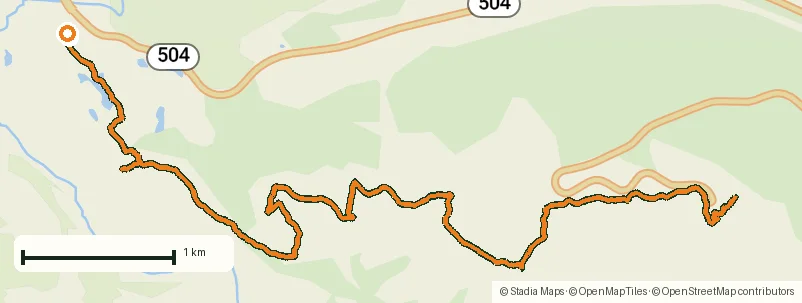
Download GPX Coordinates, elevation and relative times — recording dates are normalized out, photos not included.

A landscape with a timestamp
The blast zone is regrowth in fast-forward, different every single year. That's what makes a dated, recorded track interesting here: this line and these photos are a snapshot of the recovery — walk it again in five years and compare.
POIs as a field notebook
Viewpoints, the best lupine patches, the parking spot with the perfect crater view — all pinned with photos and notes. This is also the very track whose POIs appear in NomadTracks's App Store screenshots.
About the place: Mount St. Helens, Washington, USA
Mount St. Helens National Volcanic Monument in Washington preserves the landscape of the 1980 eruption, and the trails through the hummocks — house-sized chunks of the former summit — read like an open geology book. The Coldwater and Johnston Ridge area is snow-free roughly June to October; lupines peak in July, recolonizing ground that was sterile rock within living memory.
More track stories
- Overlanding Namibia: 4,250 km from the Kalahari to the Kunene
- Mount Whitney in two days: 24 km to the roof of the Lower 48
- Camps Bay to Table Mountain: the steep way up Cape Town's icon
- Dürrensee to the Drei Zinnen: a Dolomites classic
- Sailing the Šibenik archipelago: 69 nautical-style kilometers under sail
- Canoeing Caddo Lake: 9 km through a flooded cypress forest
- Mount Shasta mountain-bike loop: 28.6 km of volcano singletrack
- Lofoten lake hike: 9.6 km through Norway's green wilderness
- Cinder Cone, Lassen Volcanic NP: a 6 km climb up a perfect volcano
- Drakensberg amphitheatre: 13 km to the top of Tugela Falls
- The Olive Trail, Namib-Naukluft: 10.9 km through a desert canyon
- Double O Arch via Devils Garden: 12 km through Arches' fin country
- The everyday loop: 12 km of redwoods and fog above Redwood City
- Lake Tahoe rim ride: 28 km of singletrack above the blue
- Dewey Point in winter: 12 km on snowshoes to Yosemite's quiet rim
- Pinnacles High Peaks loop: 12 km among the condor spires
- Golden Canyon to Zabriskie badlands: 6 km below sea level
- Hoh Rain Forest: a 4 km walk through the moss cathedral
- Oahu waterfall trail: 5 km of mud, roots and jungle
- Riding to Lake Helen: 17 km up a closed park road through the snow
- Phillips Cave: a 6.5 km walk to Namibia's White Elephant rock art
- Koiimasis: 9 km through the granite of the Tiras Mountains
- Cathedral Gorge: a short ride through Nevada's clay cathedral
- Riding Black Rock City: the GPS trace of a city that doesn't exist
- Peekaboo Loop, Bryce Canyon: 15 km among the hoodoos