Hiking · Namib-Naukluft, Namibia · recorded with NomadTracks
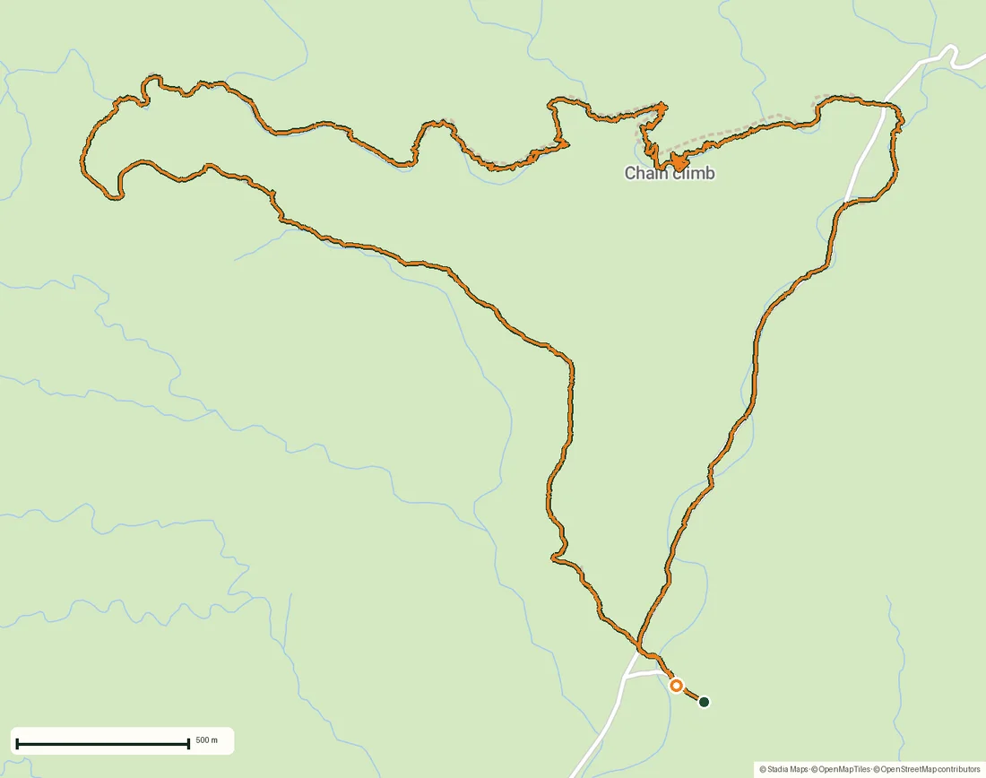
The Olive Trail, Namib-Naukluft: 10.9 km through a desert canyon
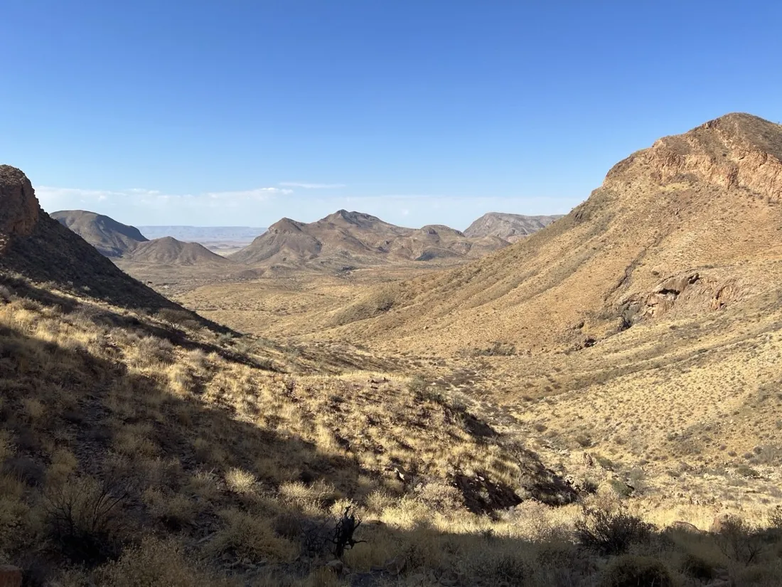
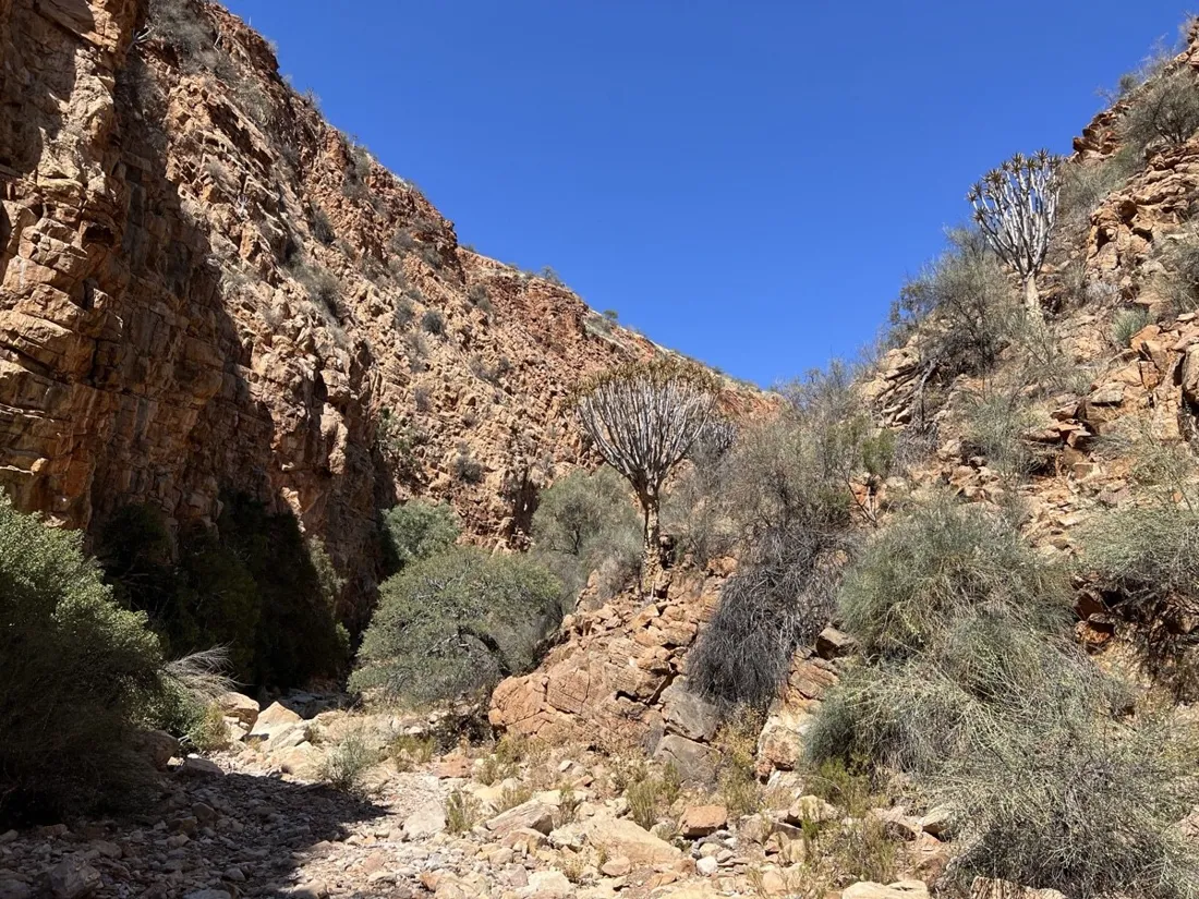
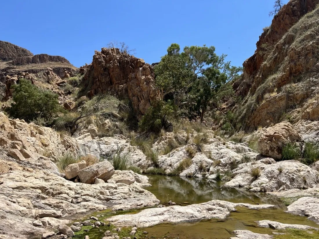
The Olive Trail is the Naukluft's classic half-day loop: 10.9 km up a plateau of wild olives, then down into a canyon that narrows until you're traversing above green pools on chains bolted to the rock. Roughly 500 m of climbing, all of it interesting.
About this data: this track and its photos were personally shared with us as samples by a NomadTracks user. NomadTracks never uploads, collects or shares your tracks or photos — your recordings stay on your devices and in your own cloud.
Download GPX Coordinates, elevation and relative times — recording dates are normalized out, photos not included.

A canyon that hides its water
In one of the driest landscapes on earth, the canyon hoards improbable pools of green water. They make perfect POIs — pinned with photos and exact coordinates, because 'somewhere in the narrows' is not a place you can send a friend to.
Why record in a canyon
GPS in slot canyons gets patchy — and that's useful to see honestly. The recorded line shows exactly where the walls pinched reception, while the entry and exit waypoints keep the navigation anchored. Combined with the park's paper map as an overlay, the loop is unambiguous.
About the place: Namib-Naukluft, Namibia
The Olive Trail is the classic half-day loop of the Naukluft mountains inside Namib-Naukluft National Park, starting near the park office between Solitaire and Sesriem. Wild olives shade the plateau, and the canyon section traverses above seasonal pools on fixed chains. Start at first light — by 11:00 the rock radiates desert heat even in the May–September cool season.
More track stories
- Overlanding Namibia: 4,250 km from the Kalahari to the Kunene
- Mount Whitney in two days: 24 km to the roof of the Lower 48
- Camps Bay to Table Mountain: the steep way up Cape Town's icon
- Dürrensee to the Drei Zinnen: a Dolomites classic
- Sailing the Šibenik archipelago: 69 nautical-style kilometers under sail
- Canoeing Caddo Lake: 9 km through a flooded cypress forest
- Mount Shasta mountain-bike loop: 28.6 km of volcano singletrack
- Lofoten lake hike: 9.6 km through Norway's green wilderness
- Cinder Cone, Lassen Volcanic NP: a 6 km climb up a perfect volcano
- Drakensberg amphitheatre: 13 km to the top of Tugela Falls
- Mount St. Helens: 16 km through the blast zone to the viewpoints
- Double O Arch via Devils Garden: 12 km through Arches' fin country
- The everyday loop: 12 km of redwoods and fog above Redwood City
- Lake Tahoe rim ride: 28 km of singletrack above the blue
- Dewey Point in winter: 12 km on snowshoes to Yosemite's quiet rim
- Pinnacles High Peaks loop: 12 km among the condor spires
- Golden Canyon to Zabriskie badlands: 6 km below sea level
- Hoh Rain Forest: a 4 km walk through the moss cathedral
- Oahu waterfall trail: 5 km of mud, roots and jungle
- Riding to Lake Helen: 17 km up a closed park road through the snow
- Phillips Cave: a 6.5 km walk to Namibia's White Elephant rock art
- Koiimasis: 9 km through the granite of the Tiras Mountains
- Cathedral Gorge: a short ride through Nevada's clay cathedral
- Riding Black Rock City: the GPS trace of a city that doesn't exist
- Peekaboo Loop, Bryce Canyon: 15 km among the hoodoos