Mountain biking · Lassen Volcanic National Park, California, USA · recorded with NomadTracks
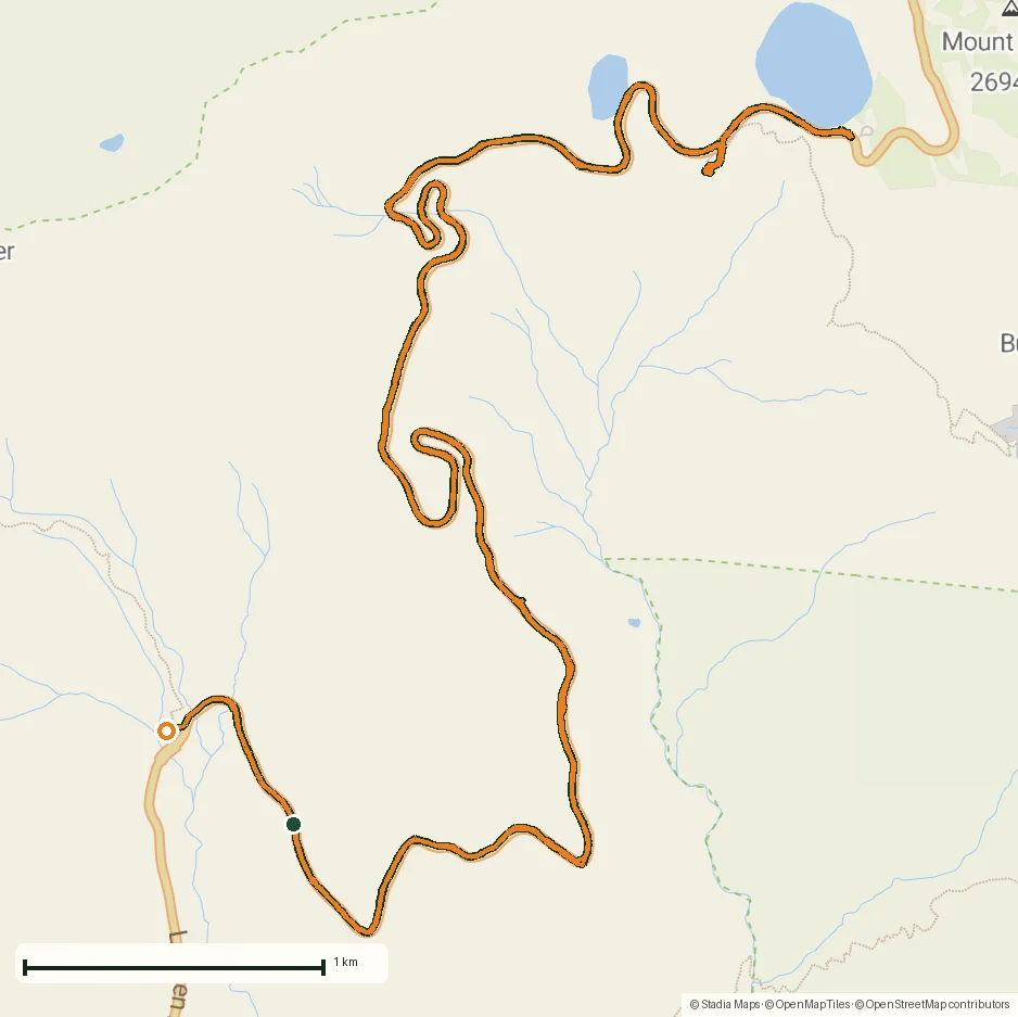
Riding to Lake Helen: 17 km up a closed park road through the snow
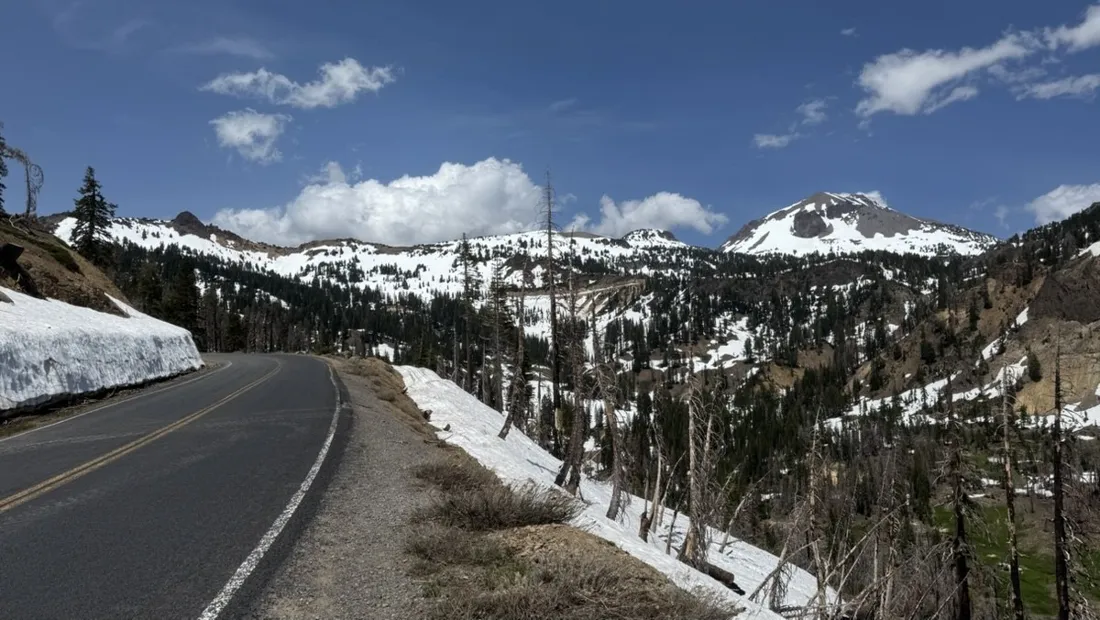
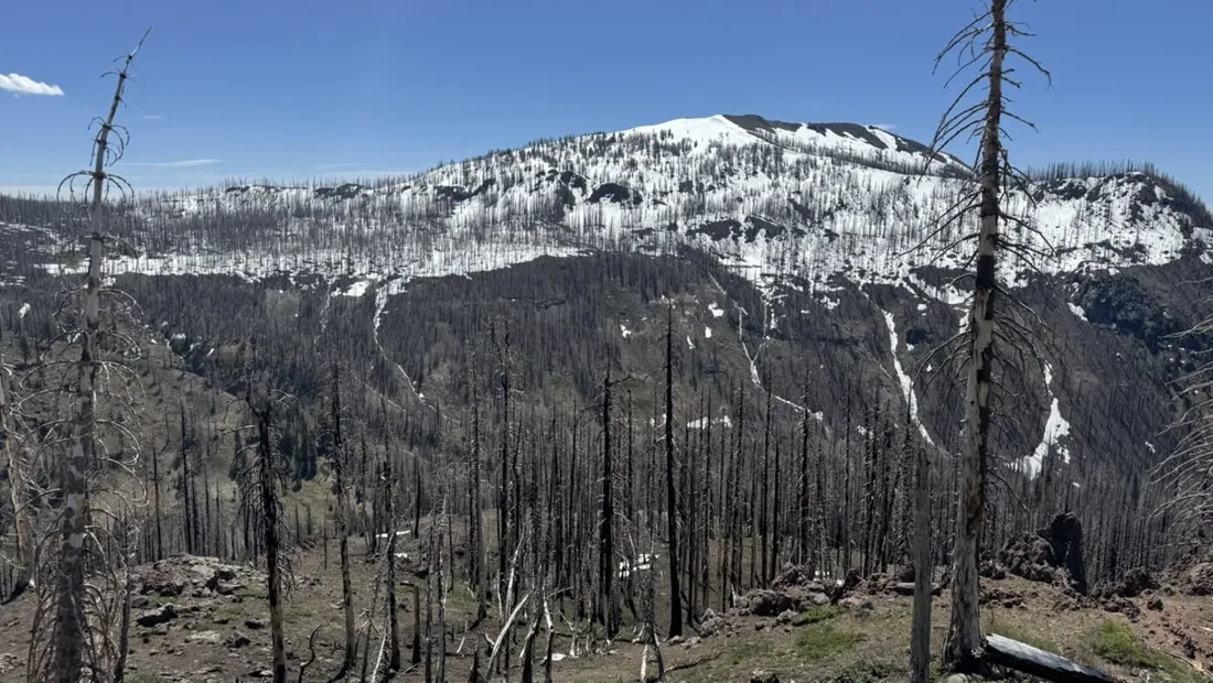
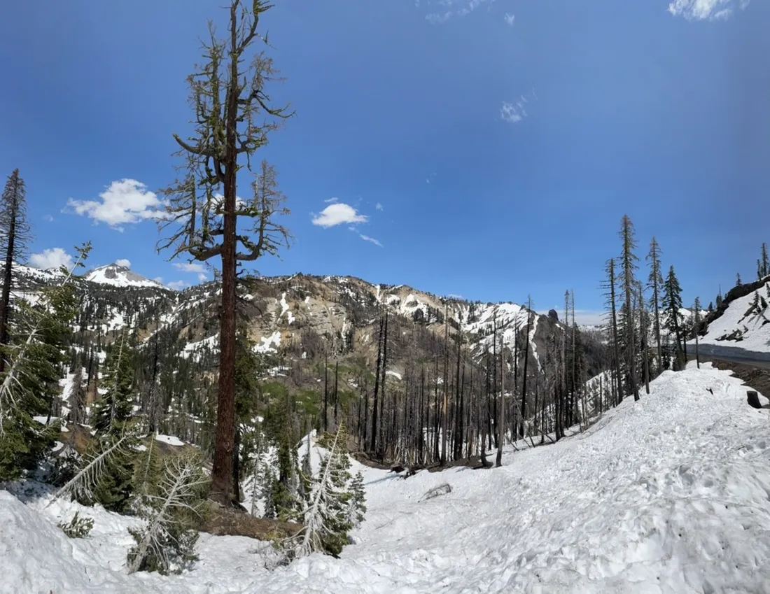
Every spring there's a golden window in Lassen: the park highway is plowed but still closed to cars. Result — 17 km of empty mountain asphalt between head-high snowbanks, all the way up to the frozen Lake Helen, shared only with other riders.
About this data: this track and its photos were personally shared with us as samples by a NomadTracks user. NomadTracks never uploads, collects or shares your tracks or photos — your recordings stay on your devices and in your own cloud.
Download GPX Coordinates, elevation and relative times — recording dates are normalized out, photos not included.

The closed-road season
No traffic, no noise, just the climb. The recorded track captures the strange beauty of it: a highway profile (steady 5–6%) in a snowscape that normally belongs to skiers.
One long climb, one long reward
The elevation chart is a single clean ramp followed by a single clean descent — 380 m up, then 20 minutes of grinning back down. The speed chart's two halves could not look more different.
About the place: Lassen Volcanic National Park, California, USA
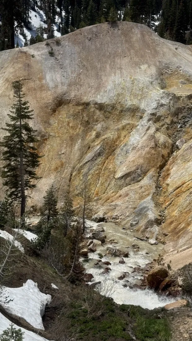
Each spring, Lassen Volcanic National Park plows its 50-kilometer park highway weeks before opening it to cars — and cyclists get a snow-walled mountain road to themselves, usually in May or early June. Lake Helen, near the road's 2,594 m high point, often stays frozen into July; the Sulphur Works thermal area steams right beside the asphalt on the way up.
More track stories
- Overlanding Namibia: 4,250 km from the Kalahari to the Kunene
- Mount Whitney in two days: 24 km to the roof of the Lower 48
- Camps Bay to Table Mountain: the steep way up Cape Town's icon
- Dürrensee to the Drei Zinnen: a Dolomites classic
- Sailing the Šibenik archipelago: 69 nautical-style kilometers under sail
- Canoeing Caddo Lake: 9 km through a flooded cypress forest
- Mount Shasta mountain-bike loop: 28.6 km of volcano singletrack
- Lofoten lake hike: 9.6 km through Norway's green wilderness
- Cinder Cone, Lassen Volcanic NP: a 6 km climb up a perfect volcano
- Drakensberg amphitheatre: 13 km to the top of Tugela Falls
- The Olive Trail, Namib-Naukluft: 10.9 km through a desert canyon
- Mount St. Helens: 16 km through the blast zone to the viewpoints
- Double O Arch via Devils Garden: 12 km through Arches' fin country
- The everyday loop: 12 km of redwoods and fog above Redwood City
- Lake Tahoe rim ride: 28 km of singletrack above the blue
- Dewey Point in winter: 12 km on snowshoes to Yosemite's quiet rim
- Pinnacles High Peaks loop: 12 km among the condor spires
- Golden Canyon to Zabriskie badlands: 6 km below sea level
- Hoh Rain Forest: a 4 km walk through the moss cathedral
- Oahu waterfall trail: 5 km of mud, roots and jungle
- Phillips Cave: a 6.5 km walk to Namibia's White Elephant rock art
- Koiimasis: 9 km through the granite of the Tiras Mountains
- Cathedral Gorge: a short ride through Nevada's clay cathedral
- Riding Black Rock City: the GPS trace of a city that doesn't exist
- Peekaboo Loop, Bryce Canyon: 15 km among the hoodoos