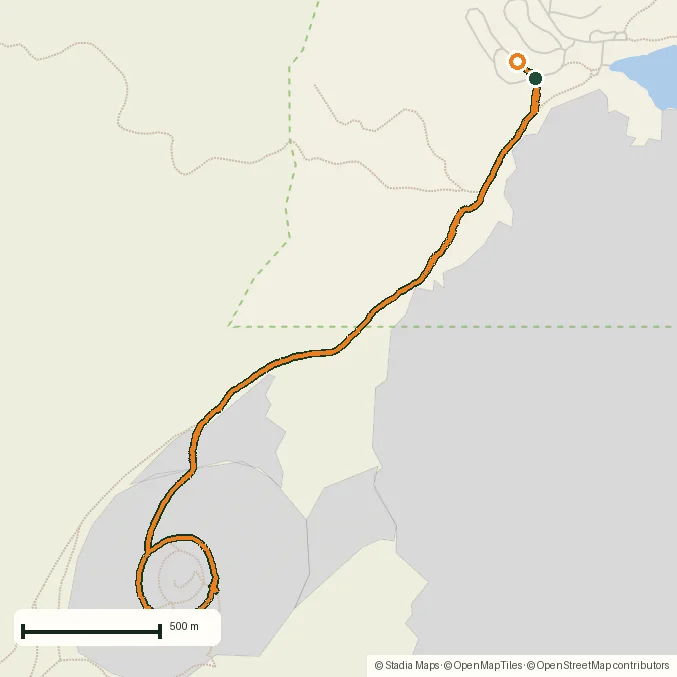
Hiking · Lassen Volcanic National Park, California, USA · recorded with NomadTracks
Cinder Cone, Lassen Volcanic NP: a 6 km climb up a perfect volcano
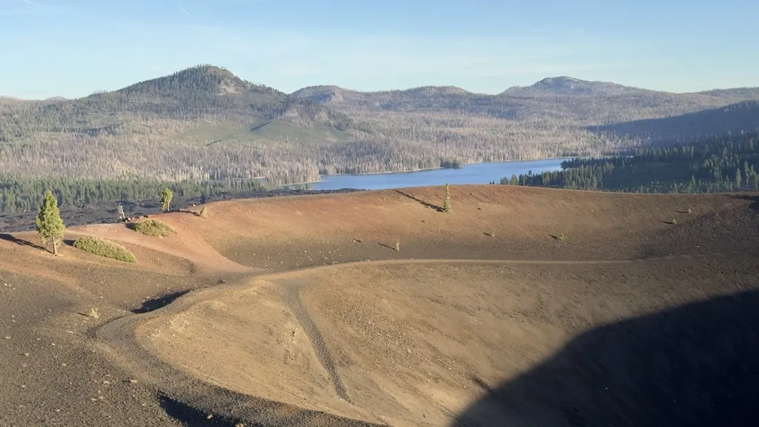
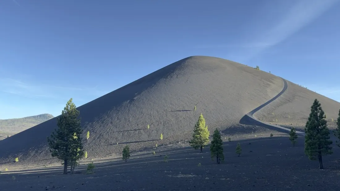
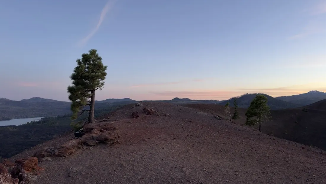
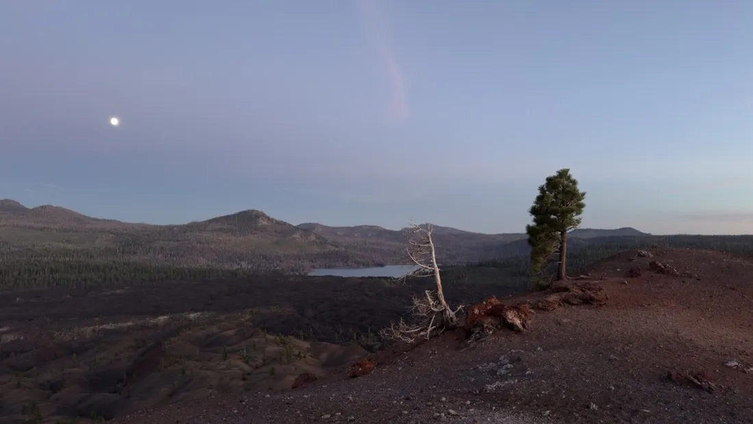
The Cinder Cone in Lassen's quiet northeast corner is geometry made landscape: a 230-meter cone of loose black gravel, a double crater rim, and the orange-and-grey Painted Dunes spreading below. Six kilometers round trip — but the cone's two-steps-up-one-back surface earns every meter of the 263 m gain.
About this data: this track and its photos were personally shared with us as samples by a NomadTracks user. NomadTracks never uploads, collects or shares your tracks or photos — your recordings stay on your devices and in your own cloud.
Download GPX Coordinates, elevation and relative times — recording dates are normalized out, photos not included.

The slope that eats your pace
The pace chart of this recording is comedy: brisk forest kilometers, then a near-standstill crawl up the cone's flank. Loose cinder gravel halves your speed and the chart proves it — bring it up next time someone calls 6 km 'a short walk'.
This is the track from our screenshots
If the name sounds familiar: the Cinder Cone hike is the very track shown in NomadTracks's App Store screenshots — photos pinned to the line, elevation chart and all. Here is the real recording behind them.
About the place: Lassen Volcanic National Park, California, USA
The Cinder Cone sits in the quiet northeastern corner of Lassen Volcanic National Park, California, reached from the Butte Lake campground off Highway 44. The cone, its double crater rim and the surrounding Painted Dunes and Fantastic Lava Beds all date to an eruption around 1666; the park road and trailhead are typically snow-free from June to October.
More track stories
- Overlanding Namibia: 4,250 km from the Kalahari to the Kunene
- Mount Whitney in two days: 24 km to the roof of the Lower 48
- Camps Bay to Table Mountain: the steep way up Cape Town's icon
- Dürrensee to the Drei Zinnen: a Dolomites classic
- Sailing the Šibenik archipelago: 69 nautical-style kilometers under sail
- Canoeing Caddo Lake: 9 km through a flooded cypress forest
- Mount Shasta mountain-bike loop: 28.6 km of volcano singletrack
- Lofoten lake hike: 9.6 km through Norway's green wilderness
- Drakensberg amphitheatre: 13 km to the top of Tugela Falls
- The Olive Trail, Namib-Naukluft: 10.9 km through a desert canyon
- Mount St. Helens: 16 km through the blast zone to the viewpoints
- Double O Arch via Devils Garden: 12 km through Arches' fin country
- The everyday loop: 12 km of redwoods and fog above Redwood City
- Lake Tahoe rim ride: 28 km of singletrack above the blue
- Dewey Point in winter: 12 km on snowshoes to Yosemite's quiet rim
- Pinnacles High Peaks loop: 12 km among the condor spires
- Golden Canyon to Zabriskie badlands: 6 km below sea level
- Hoh Rain Forest: a 4 km walk through the moss cathedral
- Oahu waterfall trail: 5 km of mud, roots and jungle
- Riding to Lake Helen: 17 km up a closed park road through the snow
- Phillips Cave: a 6.5 km walk to Namibia's White Elephant rock art
- Koiimasis: 9 km through the granite of the Tiras Mountains
- Cathedral Gorge: a short ride through Nevada's clay cathedral
- Riding Black Rock City: the GPS trace of a city that doesn't exist
- Peekaboo Loop, Bryce Canyon: 15 km among the hoodoos